
 Hike with MIT: Reinhardt Redwood Regional Parkhttps://www.ebparks.org/parks/reinhardt-redwood
Date: Saturday, September 14, 2024
Time: 10:00 AM - 2:00 PM PT
Distance: ~ 7.0 miles
Elevation Gain: 1300' Moderate
Est. Time: 4-5 hours
Parking/entrance fee: $5 payable in cash at the entry kiosk Restrooms are available at the trailhead and at several points along the hike (see park map). Dogs are allowed ($2 fee) but must be on a leash.
Click Here To Register
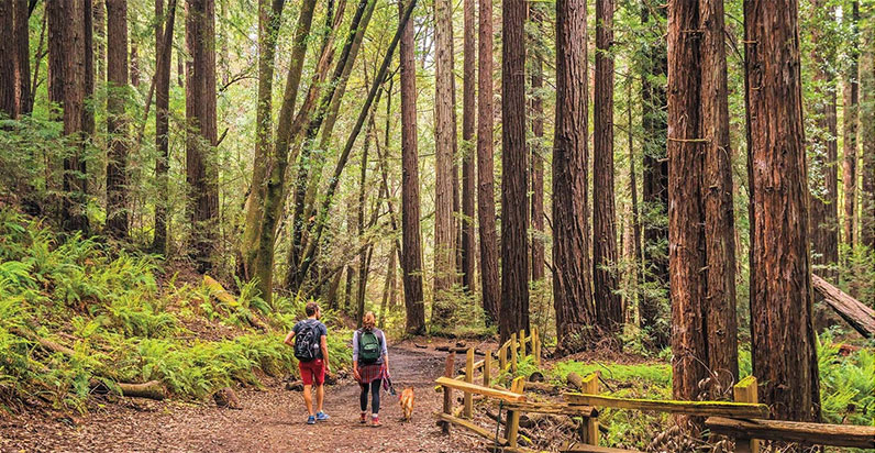
Description: A hidden redwood forest lies off Redwood Road just a few miles over the ridge from downtown Oakland. In addition to a great forest of coast redwoods, the park's 1,830 acres also contain other evergreens, chaparral, and grasslands. Deer, raccoons, rabbits, and squirrels are often seen. On a previous hike in September 2018 we saw thousands of migrating ladybugs.
The hike begins at the Canyon Meadow Staging Area and follows the mostly flat Stream Trail about 2.9 miles to our lunch spot at the Skyline Gate. Water and restrooms are here. The return is via the French Trail which has a number of moderate to steep inclines and declines through a dense forest.
A map of Redwood Regional Park may be downloaded at https://www.ebparks.org/sites/default/files/R-Redwood-MapBr-2023-09-28-web.pdf
What to Bring: Start your day with a hearty breakfast. There is some sun exposure along the Stream Trail, but the second half of the hike is mostly shaded under redwoods. Sunblock and a hat are recommended, along with plenty of water (at least 2 quarts per person). Dressing in layers with a windbreaker is a good idea. Bring snacks and a lunch.
Directions: Take exit 1 for Redwood Road from Highway 13 in Oakland. Follow Redwood Road uphill about 2 miles to the Redwood Gate (park entrance). Park at the Canyon Meadow staging area.
Google Earth coordinates: 37º 48' 34.72" N, 122º 8' 31.99" W
Carpooling: Carpooling is always a nice idea. The https://www.groupcarpool.com/ site might be worth using. Check back later or contact me for details.
Rain policy: If there's any ambiguity about the weather on the day of the hike, you can check the forecast the morning of the hike. The NWS forecast for the Oakland hills may be found at https://forecast.weather.gov/MapClick.php?lon=-122.18601137180556&lat=37.82933642458576#.W5CTwH4nbDY
If it's raining significantly, the hike is off. If the weather is ambiguous, we will send out an email to all that have registered or sent an RSVP.
Click Here To Register
Event Organizer
MIT Club of Northern California
clubadmin@mitcnc.org